Little Harbour, Nova Scotia
Little Harbour Geography
- Official Name: Little Harbour
- Gaelic Name: An Acarsaid Bheag
- Mi’kmaq Name: Menpekwik – meaning erosion
- Geographic Feature Type Category: Populated Place
- Geographic Feature Type: Community
- Latitude / Longitude: 45.646939, -62.561766
Note: The name Little Harbour also refers to the hydrographic feature: Harbour. A sheltered body of water near the coast partially covered by land, often ideal for boats to be docked.
- Official Name: Little Harbour
- Geographic Feature Type Category: Hydrographic Feature
- Geographic Feature Type: Harbour
- Latitude / Longitude: 45.654732, -62.538803
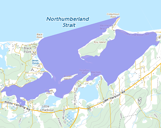
Little Harbour Maps
- 1:50k Topographic NTS Map: 011E10
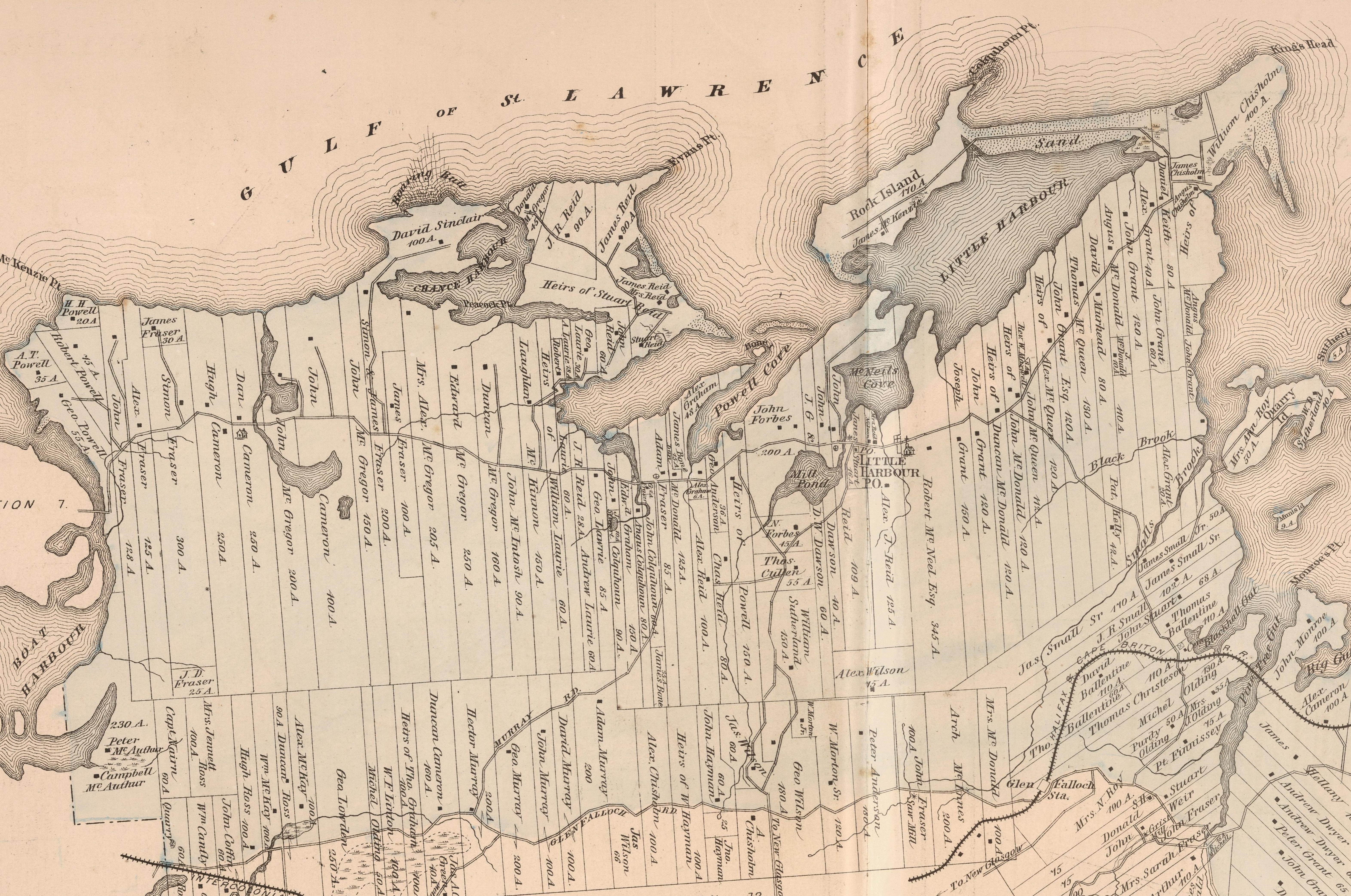
- 1879 Pictou County Atlas Map: Section 14
- Nova Scotia Land Grant Map: NS Land Grant map 092 & NS Land Grant map 093
- Nova Scotia 1:10k Topographic Maps: 1045600062500 (Little Harbour) / 1045650062500 (Chance Harbour)
- Other Maps: Aerial Images and 3D Lidar generated maps
About Little Harbour
Little Harbour is a rural coastal community located along the Northumberland Strait on the south side of Little Harbour. Mi’kmaq name for the area is “Menpekwik” meaning Erosion. Another source states that it was called “Munbeqweck”, which meant little harbour (it is possible that this was a miss spelling of the first word).
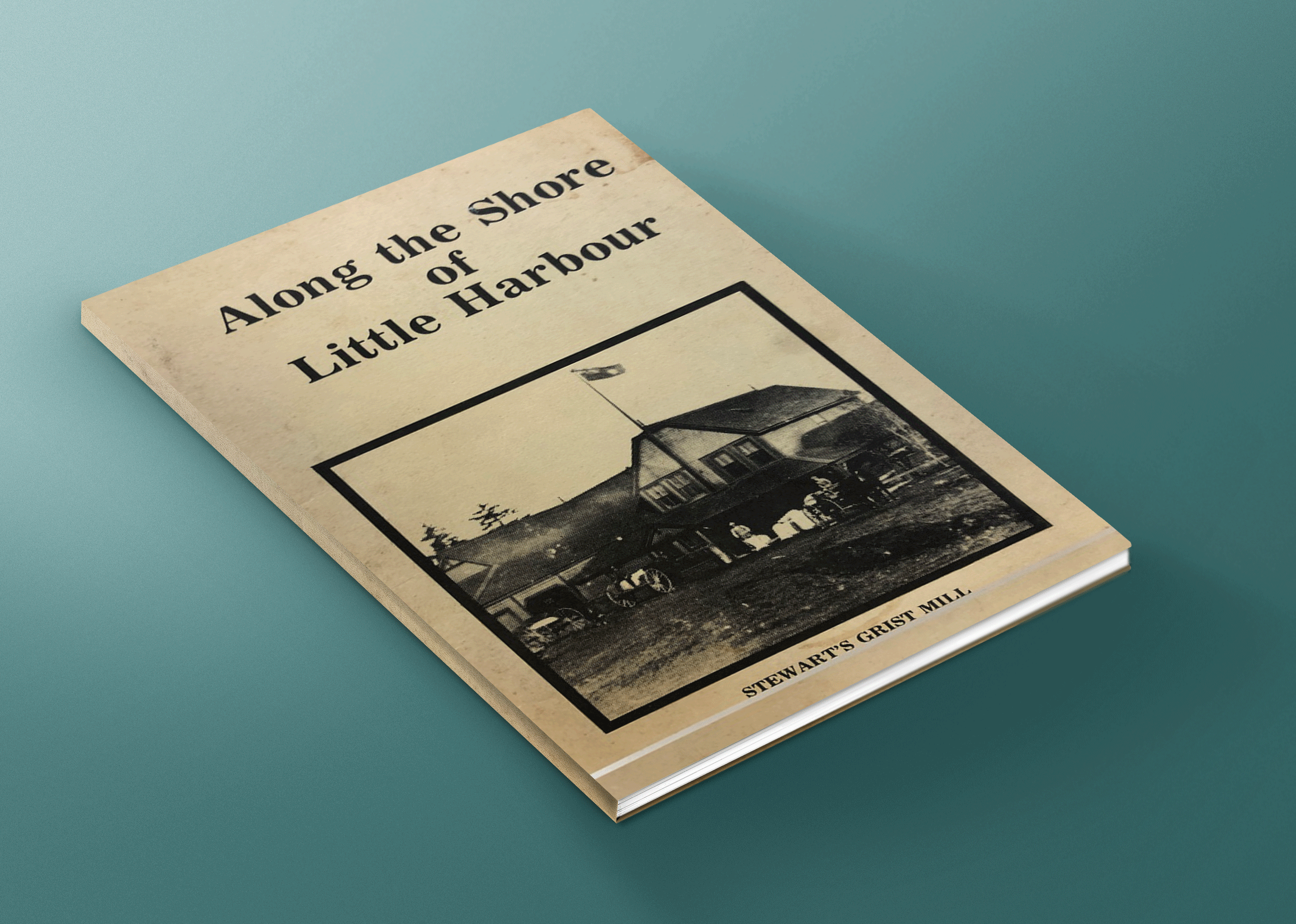
The area around Little Harbour was once a battle zone ; between the Canibas (or Abernaki), Miꞌkmaw of this area. For some time, hostility existed between the two tribes. After several back and forth attacks, eventually a peace was formed between the two (for more details on this story, check out Along the shore of Little Harbour).
The Acadians lived here during the early 1700’s. Settlers from the Britain didn’t arrive till around 1773. They often found remains of French homes and, under almost every chimney, would be a brass kettle, along with some other small items. In 1815 a number of British immigrants settled in this here.
The first will ever probated in Pictou County was recorded in 1812 (for James Reid of Little Harbour).
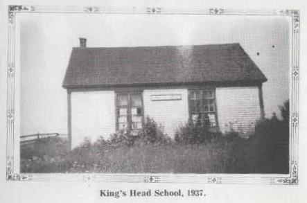 The first school was operated out of a home located opposite the Powell road. A school was built In 1821 located on School
House Hill (just off the Woodburn Road).
In 1824, a Grist Mill and kiln for flour and oat was built by Angus MacDonald, known as the Little Harbour Mill. Farmers from the area all used it, and some even came as far as Merigomish and Cape John. Another mill was located at Graham’s Dam, but was later destroyed by a fire.
By 1828 there were about five hundred people in the vicinity.
In 1848, a more modern mill was erected by James Grant, that three run of stones for the manufacture of flour and oatmeal, and a larger kiln with iron beams and a cast metal head for drying oats. Several mills in the area were operated until around 1942.
A Church was opened in 1876, but burnt down 1924 and was replaced with a new church. A school was built by 1822. A postal way office was established in 1855, and continued there until 1944.
A lighthouse was completed on the hill above the beach at King’s Read 1882.
The first store, a small confectionary and tobacco shop was opened by Bella MacKenzie, around 1900.
In 1932, a fire that originated around Trenton, swept through the woods to the Chance Harbour shore. It burned
everything green along the way. A change in the direction of the wind enabled firefighters to bring the blaze under control without much damage to homes.
In 1968, a Provincial Park at Powell’s Point, was developed. The park is still in use as a day park; with beaches, picnic area, and trails.
Population in 1828 was 500.
Population in 1881 was 900.
Population in 1956 was 99.
Note: Current population for the area is harder to determine because Statistics Canada now combines Little Harbour population with surrounding communities in Pictou, Subd. C (this includes communities from Pictou Landing to Lismore, and south to the county line).
For more history see …
Along the shore of Little Harbour by Marie Cullen, Shirley Aikens, & Margaret Forbes, is a great resource for stories and history of Little Harbour and surroundings area (Anderson Mountain, Black Point, Boat Harbour, Chance Harbour, Kings Head, Little Harbour and Woodburn).
It provides details about many of the families that first settled the area, businesses, industry, hard ships, churches, schools, fire stations, and more. This book is now available to read online.
Local Information …
Check out the community of Little Harbour’s webite for local information on recreations, events, community center, churches and more.
Using the crowd sourced Find a Grave app, you can search the Church Brook Cemetery or the Little Harbour Pioneer Cemetery for names, details, and photo
[Sources: Nova Scotia Place Names – T. Brown / Places of Nova Scotia – C. Bruce Fergusson / Along the shore of Little Harbour – Marie Cullen, Shirley Aikens, & Margaret Forbes]
Little Harbour Map
Disclaimer
Historic details included in the Pictou County Place Names Atlas will always include source of information when available, and is intended for educational purposes (we have not taken the time to validate any claims).
Links to other sites and historic resources are shared for informational purposes; they do not necessary constitute an endorsement or an approval by PictouCounty.net. We have no control over the content on any other sites (as people can change content from time to time). We make no claims or guarantees about the accuracy or currency of the contents and expressly disclaim liability for errors and omissions in its contents.
You understand and agree that any material downloaded or otherwise obtained through the use of this website is done so, at your own risk and discretion and that you will be solely responsible for any damages to your computer system (or electronic device) or loss of data that may result from downloading any such material (or sites linked to from this site).

