
Sutherlands River, Nova Scotia
Sutherlands River Geography
- Official Community Name: Sutherlands River
- Gaelic Name: Abhainn An t-Sùtharlanaich
- Geographic Feature Type Category: Populated Place
- Geographic Feature Type: Community
- Postal Code: B0K 1W0, B0K 1G0
- Latitude / Longitude: 45.587052, -62.497709
- Official Community Name: Sutherlands River
- Geographic Feature Type Category: Hydrographic Feature
- Geographic Feature Type: River
- Latitude / Longitude: 45.587305, -62.500544
Sutherlands River Maps
- NTS Map Number: 011E10
- 1:250k Topographic NTS Map: 011E
- 1879 Pictou County Atlas: Section 14
- Nova Scotia Land Grant Map Number: NS Land Grant map 093
- Nova Scotia 1:10k Topographic Map Number: 1045550062500 (Thorburn)
- Other Maps:

[Source: Nova Scotia Place Names – T. Brown / Places of Nova Scotia – C. Bruce Fergusson ]
About Sutherlands River
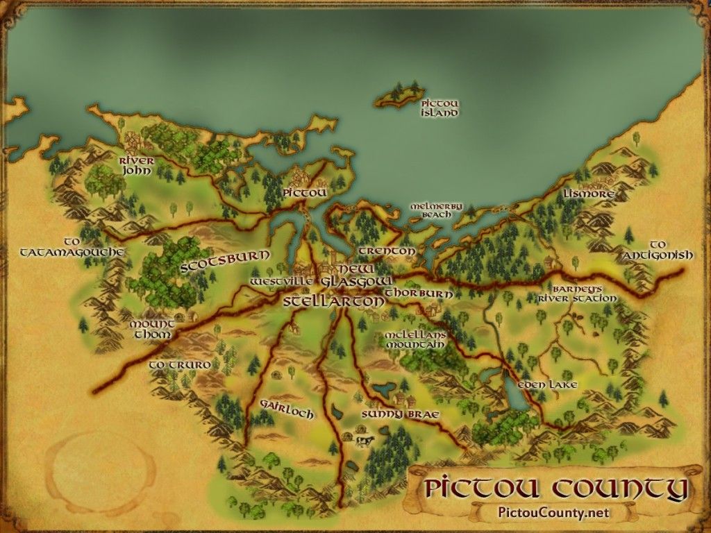
Sutherlands River is a rural community is located near the mouth of the Sutherlands River just south of Merigomish Harbour. It was named after John Sutherland who arrived on the ship Hector in 1773 and settled in this area soon after. The land was part of a grant made to Sir John Wentworth in October, 1765.
The name of the community was once Sutherland River but was officially changed to Sutherlands River in 1961.
Union Presbyterian Church was built in 1854, and a postal way office was established in 1856.
The East Pictou Rural High School went into service in 1952. The school was torn down in 2023 after it was no longer being used after getting replaced by North Nova Education Centre in New Glasgow.
The Trans-Canada Highway runs through Sutherlands River.
Population in 1956 was 171
Using the crowd sourced Find a Grave App, you can search the Sutherland’s River Pioneer Cemetery (including names, photos and more).

The River originates in Kerrowgare area west of Burroughs Lake and flows north through the communities of Blanchard Road, Blue Mountain, Mclellans Mountain, McPhersons Mills, Sutherlands River where it drains into Merigomish Harbour.
Disclaimer
Historic details included in the Pictou County Place Names Atlas will always include source of information when available, and is intended for educational purposes (we have not taken the time to validate any claims).
Links to other sites and historic resources are shared for informational purposes; they do not necessary constitute an endorsement or an approval by PictouCounty.net. We have no control over the content on any other sites (as people can change content from time to time). We make no claims or guarantees about the accuracy or currency of the contents and expressly disclaim liability for errors and omissions in its contents.
You understand and agree that any material downloaded or otherwise obtained through the use of this website is done so, at your own risk and discretion and that you will be solely responsible for any damages to your computer system (or electronic device) or loss of data that may result from downloading any such material (or sites linked to from this site).

