Avondale, Nova Scotia
Avondale Geography
- Official Name: Avondale
- Gaelic Name: Abhainn Dail
- Geographic Feature Type Category: Populated Place
- Geographic Feature Type: Community
- Latitude / Longitude:45.63651, -62.299827
- Official Name: Avondale Station
- Gaelic Name: Stéisean Abhainn Dail
- Geographic Feature Type Category: Populated Place
- Geographic Feature Type: Locality
- Latitude / Longitude: 45.625927, -62.295737
Avondale Maps
- 1:50k Topographic NTS Map: 011E09
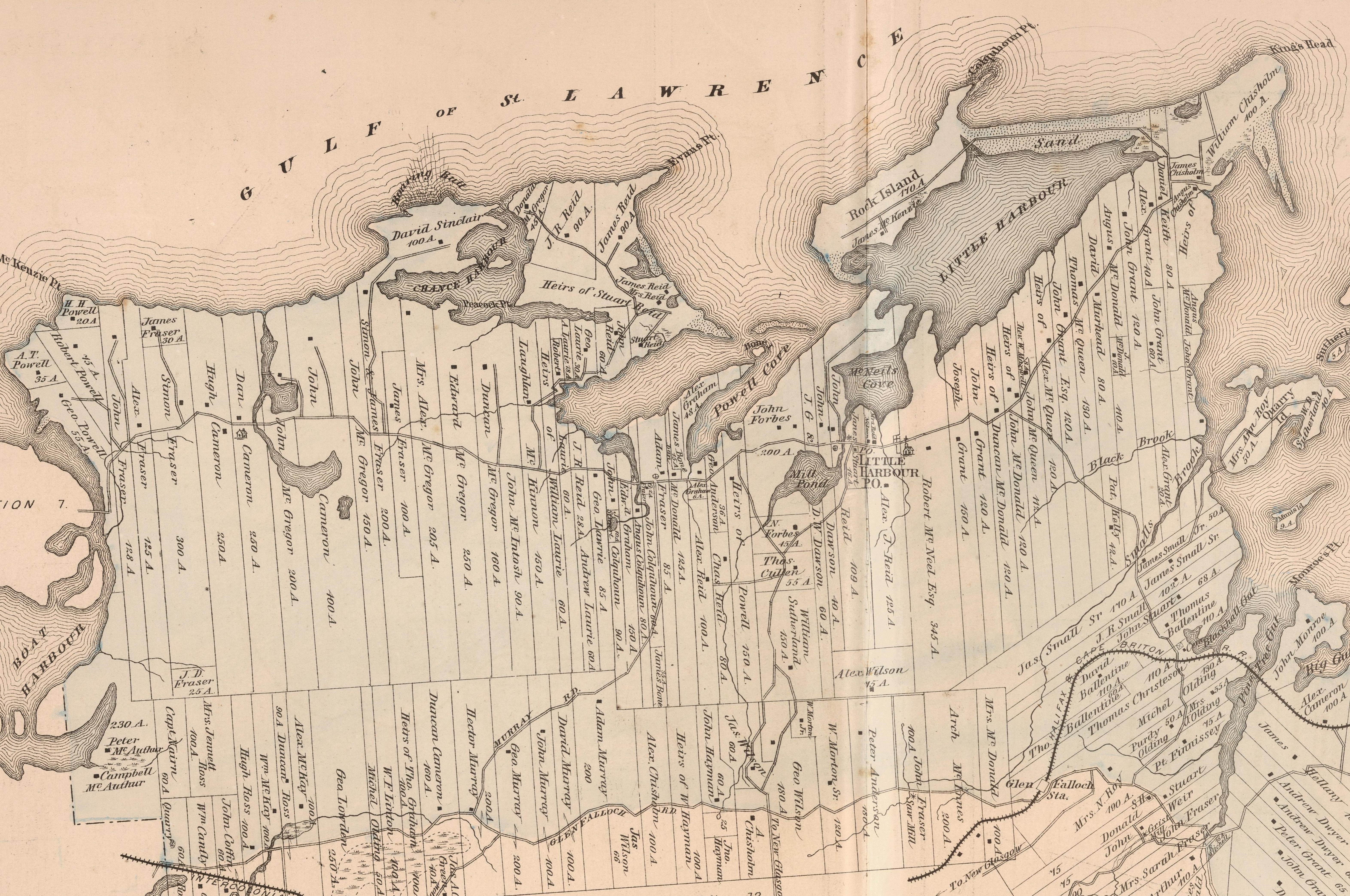
- 1879 Pictou County Atlas Map: Section 20
- Nova Scotia Land Grant Map: NS Land Grant map 093
- Nova Scotia 1:10k Topographic Maps: 1045600062300 (Brownsville), 1045600062200 (Avondale Station)
- Other Maps:
Avondale is a small rural community located south of Lower Barneys River and north of Barneys River Station.
This community was known as Central Barneys River until the name was changed at a public meeting in 1869. Then it became Avondale, named after the beauty of its surroundings which had similar appearance to the Avon River in England.
“Avon” is a Gaelic word for for river.
The Eastern Extension Railway was constructed through here in 1879. Settlement here began in the 1780’s by Samuel Holmes, Robert McDonald, Gregor McGregor and Robert Stewart. William Hattie received a land grant here in 1816, and built one of the first mills in the Merigomish area.
Avondale Station, is a rural area in the community of Avondale located where the railway crossed through the community, and its name was adopted in 1879. In the early days there were many railway stations located along the route because trains had to stop and service so many communities. Around the 1950s, when the evolution of diesel engines and automobiles came along, there became less of a need for all the railway stations stops, and most just became rural areas.
A Baptist church was built in 1874, the building was well made, but the inside was never really finished. Around the year 1900 the lumber was sold to a local who used it build a new house.
South of Avondale Station, along the west side of Barneys River was a good sized factory built for woodworking furniture such as beds, bureaus, chairs, tables, cabinets and more. It was destroyed by a fire about 20 years after it was built.

A school house was built near the banks of the river in 1802. Much later another school was built near the railway yard in 1879. The Avondale school burned down in 1944, and was later replaced with a new building in 1945.
The first automobile in Avondale was about 1914, it was a one seater car, manufactured in Amherst, Nova Scotia. A cement subway crossing was built under the railway to allow trains to pass over the many automobiles now traveling along the road. It was a often dangerous under pass with bad visibility.
In 1970, like many in other communities in the area, the Avondale post office post office was moved to Merigomish.
Population in 1956 was 56.
Between 2015 and 2018 Northumberland Wind Field Inc. worked on the Avondale Project building wind mills to generate green sustainable electricity for use in local rural communities. It is located on Doliber Mountain, off Barney’s River Road in Avondale
Avondale and its People is a 2 part book series provides a historic look into the lives of many early settlers who came to live in Avondale and its surrounding areas (Piedmont, Merigomish, Baileys Brook, Kenzieville etc.) capturing the essence of the area’s history, while offering a glimpse into the rich heritage of the region, spanning from family histories, agricultural practices, to the impacts that technology and transportation had on the community over the years.
This book is now available to read free online.
Using the crowd sourced Find a Grave app, you can search the Hattie Cemetery for names, details, photos and more.
1879 Avondale Map
Disclaimer
We are not the creator of all the cartographic mapping products featured on this page, and are simply helping them get more public exposure (always refer to the listed source for specific details about a map or data).
Remember, the maps provided on PictouCounty.net are meant for general informational and educational purposes only. They are non authoritative and should not be used for defining boundaries or any other legal purposes. Although we are cartographers and do create many maps for this site, sometimes we are providing information about maps created by others. However, we do our best to provide details about any maps shared, including references to both the creators and map providers.
By using PictouCounty.net, you are acknowledging and accepting all inherent limitations of any maps or data included on this site. We make no claims or guarantees about the accuracy or currency of the contents of this website and expressly disclaim liability for errors and omissions in its contents.
You understand and agree that any material downloaded or otherwise obtained through the use of this website is done so, at your own risk and discretion and that you will be solely responsible for any damages to your computer system (or electronic device) or loss of data that may result from downloading any such material (or sites linked to from this site).


