
Scotsburn, Nova Scotia
Scotsburn Geography
- Official Name: Scotsburn
- Gaelic Name: Beinn Nam Mathanach
- Geographic Feature Type Category: Populated Place
- Geographic Feature Type: Community
- Latitude / Longitude: 45.651347, -62.853673
Scotsburn Maps
- 1:50k Topographic NTS Map: 011E10
- 1879 Pictou County Atlas Map: Section 6
- Nova Scotia Land Grant Map: NS Land Grant map 086
- Nova Scotia 1:10k Topographic Maps: 1045500062800 (Scotsburn)
- Other Maps:

About Scotsburn
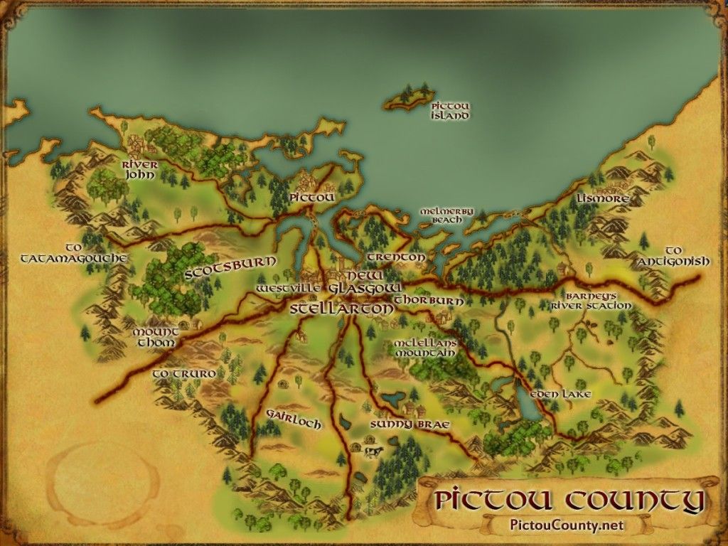
Scotsburn is a rural community located west of Durham and south of Heathbell. It was once known as known as Rogers Hill but was renamed by an Act of Parliament in 1867. It was called Rogers Hill after John Rogers (one of the settlers to arrive from Philadelphia) whose farm lot was here in the late 1700’s. The name was proposed by Hugh Ross whose birth place in Scotland, was named Scotsburn, meaning “Brook of the Scots.”
Settlement began in 1800 with Alexander Murray from Scotland. By 1806 sixteen settlers had cleared land on Rogers Hill. John McLean settled on Rogers Hill soon after 1803. Other early settlers included William Matheson, Andrew McCarra and James McCarra.
A school was established at “Rogers Village” in 1817. John Gordon arrived in 1810 and built a log house which served for a dwelling, a school and a church. A new school was erected to in 1916-17, but burnt down in May, 1929. It was replaced in 1930 by a new building
A postal way office was ·established in 1847, and latter replaced with a Post Office in 1889.
A quarry was in operation near Saw Mill Brook from about 1825 to 1873.
A new road was built through the village, in 1855, connected the community to other regions.
Scotsburn played a significant role in dairy production in Nova Scotia. In 1900, a group of local farmers incorporated the Scotsburn Creamery, initially to turn surplus milk into butter for the community. However, thanks to support from government officials such as Dairy Commissioner Dr. J. W. Robertson, and 80 local farmers purchased shares in the corporation.
The creamery struggled in its early years, but eventually expanded after more efficient cream-gathering methods were introduced. By 1919, the creamery was producing over 446,000 pounds of butter annually, with its products in high demand across Nova Scotia, New Brunswick, and as far west as Montreal. The company expanded its products to include milk, cheese, ice cream, and more leading to its success over the years.
Population in 1956 was 266.
*Note these numbers seem to be high, but population in 2011 was approximately 3,379 (based on the 2011 Census of Population, according to the Nova Scotia Department of Finance). In 2018, the population was estimated to be around 5,500 (according to Wikipedia).

[Source: Nova Scotia Place Names – T. Brown / Places of Nova Scotia – C. Bruce Fergusson / Haggis / ScotsburnMilk.ca ]
Disclaimer
Historic details included in the Pictou County Place Names Atlas will always include source of information when available, and is intended for educational purposes (we have not taken the time to validate any claims).
Links to other sites and historic resources are shared for informational purposes; they do not necessary constitute an endorsement or an approval by PictouCounty.net. We have no control over the content on any other sites (as people can change content from time to time). We make no claims or guarantees about the accuracy or currency of the contents and expressly disclaim liability for errors and omissions in its contents.
You understand and agree that any material downloaded or otherwise obtained through the use of this website is done so, at your own risk and discretion and that you will be solely responsible for any damages to your computer system (or electronic device) or loss of data that may result from downloading any such material (or sites linked to from this site).

